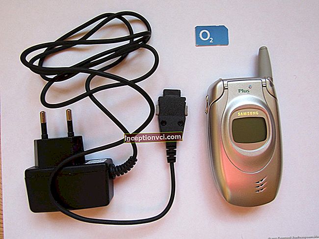
GPS navigators
This is a global positioning system (English Global Positioning System) - a set of satellites equipped with radio frequency receiving and transmitting equipment launched by order of the military department - the US Defense Department, which are used to determine the location of an object on the surface of the Earth while guiding missiles at a target and coordinating movement subsections of aviation, sea and land-based.The US War Department allowed civilian users to use the system with less precision. Using the GPS Receiver, you can accurately determine its position on the surface of the Earth. Today, in addition to special-purpose receivers, devices are produced that are mounted in wristwatches, cell phones, hand-held radio stations, with which you can navigate the terrain. They are used by climbers, rescuers, tourists.
Operating principle GPS navigators
The GPS receiver calculates its own position by measuring the time when the signal was sent from the GPS satellites. Each satellite constantly sends a message, which contains information about the time of sending the message, the point of the satellite's orbit from which the messages were sent and the general state of the system and the approximate data of the orbits of all other satellites of the GPS constellation. These signals travel at the speed of light in the universe, and at a slightly slower speed through the atmosphere. The receiver uses the time of receipt of the message to calculate the distance to the satellite, from which, using geometric and trigonometric equations, the position of the receiver is calculated. The resulting coordinates are converted into a more descriptive form, such as latitude and longitude, or position on a map, and displayed to the user.


Since it is necessary to know the time with high precision to calculate the position, it is necessary to obtain information from 4 or more satellites in order to eliminate the need for ultra-precise clocks. In other words, the GPS receiver uses four parameters to compute four unknowns: x, y, z, and t.
In some special cases, fewer satellites may be needed. If one is previously known to be removable (for example, the height above sea level of a boat in the ocean is 0), the receiver can calculate your position using data from three satellites. Also, in practice, the receivers use different auxiliary information to calculate the position with less accuracy in the absence of four satellites.
Application GPS navigators
Despite the fact that the GPS project was initially aimed at military purposes, today GPS is increasingly used for civilian purposes. Gps receivers are sold in many shops that sell electronics, they are embedded in mobile phones, smartphones and PDAs. Consumers are also offered various devices and software products that allow them to see their location on an electronic map; that they have the ability to lay routes taking into account road signs, permitted turns and even congestion; search the map for specific houses and streets, outstanding memos, cafes, hospitals, gas stations and other infrastructure.
GPS tracker (also GSM GPS tracker, GPS beacon, GPS terminal) is a receiving and transmitting device that uses two systems: the Global Positioning System to accurately determine the location of an object and cellular communication systems. For the sake of transferring location data (via gprs, edge or sms) to the command center.


GPS Tracking Systems are used to determine the location:
- vehicles (vehicle trackers that are connected to the vehicle's on-board system),
- people (personal trackers),
- animals (super compact, very light, attached directly to the collar).
Uses for trackers include:
- Transport control. For example, a transport company or a taxi service can install such a device on their cars, thus receiving information about the time and route traveled.
- Search for a stolen car. Some models have a remote engine stop function. Observing children or elderly people. Can be used to control movement. At the same time, the observer, for example, parents, has the opportunity to establish the zone in which their child can be. When crossing a predetermined zone, an alarm signal will be sent to the parents' computer or mobile phone.
Observing subordinates. Gps-Control helps to provide the route of movement of workers. For example, sales representatives, drivers, merchandisers and others. Thus, it is possible to track them, whether the personnel of the company are following the given route.
Garmin Ltd. - manufacturer of GPS-Navigation equipment.
The firm was founded in 1989 in Olate, USA.
GARMIN's main world offices are located in the United States, Taiwan and the United Kingdom. As of 2007, the company had over 7,000 qualified professionals worldwide.
Garmin devices are the leader in the quality of satellite signal reception.
From all manufacturers of navigation devices, only Garmin has an official representative in Ukraine.
Navigation (Latin navigatio - navigation from Latin navigare - to swim, swim across):
1. Theory and practice of ship control. Navigation tasks are to ensure accurate, timely and safe navigation of the ship, performing the necessary calculations for maneuvering. Navigation also includes means of determining coordinates, measuring direction and distance at sea, choosing paths and displaying the ship's course on the map, subtracting the path of the ship, determining its position in the sea behind coastal, sky and underwater landmarks, estimating the error of navigation devices.
Geotechnical, radio engineering, lighting, astronomical and other means are used in navigation.
Many ages, the term navigation meant only the above values. In the XX century, due to the development of science and technology, the emergence of aircraft, spacecraft - new objects of navigation, new values of the term have arisen. Now, in a general sense, navigation is the process of managing some object (including informational), which has its inherent methods of movement in a certain space. There are two components in navigation:
theoretical justification and practical application of object management methods
routing (its type is routing in information networks), the choice of the optimal path for the passage of an object in space.
Routing is the process of determining a route between networks. A router (or a router from the English router) makes decisions based on the IP-address of the recipient of the packet. In order to forward the packet further, all devices along the route use the recipient's IP address. To make the right decision, a router must know directions and routes to distant networks. There are two types of routing:
Static routing - routes are set manually by the administrator.
Dynamic routing - routes are calculated automatically using dynamic routing protocols - RIP, OSPF, EIGRP, IS-IS, BGP, HSRP, etc., which receive information about the typology and state of communication channels from other routers in the network.
Because static routes are manually configured, any changes to the network topology require administrator involvement to add and remove static routes as needed. In large networks, manually maintaining the routing tables can be enormous administrator time. This is easier on smaller networks.Static routing does not have the scalability that dynamic routing has through additional requirements for setup and administrator intervention. But even in large networks, static routes are often configured for special purposes in combination with dynamic routing protocols, since static routing is more stable and requires a minimum of router hardware resources to maintain the table.
Dynamic routes are exposed in a different way. After the administrator has activated and prepared dynamic routing using one of the protocols, the routing information is updated automatically during the routing process whenever new routing information is received from the network. Routers exchange messages about changes in network topology during dynamic routing.

Air navigation (air navigation) - the science of methods of flying aircraft at a given course and altitude and in compliance with a certain flight time.
The main types of air navigation:
- flight on earth landmarks;
- compass navigation;
- radio navigation;
- astronavigation.
Marine navigation is a section of navigation that studies the route of ships, theoretical justification and practical techniques for navigating sea vessels.
The Enhanced Interior Gateway Routing Protocol - (EIGRP) is a special routing protocol based on the old IGRP protocol. EIGRP is a distance vector routing protocol that has been optimized to reduce protocol volatility following network topology changes, avoid route loop problems, and use router capacity more efficiently and economically. Routers that support EIGRP also support IGRP and convert routing information for Igrp Neighbors from 32-bit EIGRP metric to 24-bit IGRP metric. The route determination algorithm is based on Dijkstra's algorithm of depth-first search on a graph. EIGRP calculates and takes into account 5 parameters for each section of the route between hosts:
Total Delay - Total transmission delay (microsecond precision).
Minimum Bandwidth - Minimum bandwidth (in Kb / s - kilobits / second).
Reliability - Reliability (score from 1 to 255; 255 is the most reliable).
Load - Loading (rating from 1 to 255; 255 most loaded).
Maximum Transmission Unit (MTU) (not taken into account when calculating the optimal route, taken into account separately) - the maximum block size that can be transmitted along a route segment.
Border Gateway ProtocolBGP (English Limiting Gateway Protocol) is the main protocol for dynamic routing on the Internet.
BGP differs from other protocols in dynamic routing, its purpose is to exchange route information not between individual routers, but between entire autonomous systems, and therefore, in addition to information about routes in the network, it also transfers information about routes to autonomous systems. BGP does not use technical metric evidence, but chooses the best route based on the rules of the network.